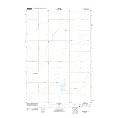
2012 Map of Fordham Dam
USGS Topo · Published 2012About this map
Foster Cr meanders across this rural section of Spink County, defining the drainage patterns and land use of the South Dakota plains. The 2012 landscape is characterized by communal agricultural settlements and water management, most notably seen at Clark Colony in the west and Huron Colony in the southeast. These colonies represent a distinct sociocultural pattern of land ownership and farming typical of the region. Local history is anchored by the Logan Cem, situated on a grid of section-line roads such as 175th St and 414th Ave. Water resources are central to the area's development, evidenced by the eponymous Fordham Dam and the smaller Logan Dam, both of which serve the irrigation and livestock needs of these specialized farming communities.
Find a feature on this map
22 named features on this map. Tap any name to fly to it.
Don’t see what you’re looking for? This feature index may not catch every label — zoom into the map to look around manually.
Map Details
Editions of this 2012 Fordham Dam Map
This is the sole edition of this map. No revisions or reprints were ever made.
Other maps of this area

1895 · Byron
USGS Topo · 1:125,000

1953 · Huron
USGS Topo · 1:250,000

1953 · Watertown
USGS Topo · 1:250,000

1954 · Huron
USGS Topo · 1:250,000

1958 · Watertown
USGS Topo · 1:250,000
1971 · Doland
USGS Topo · 1:24,000
1971 · Doland SE
USGS Topo · 1:24,000
1971 · Bloomfield
USGS Topo · 1:25,000
1973 · Baileys Lake
USGS Topo · 1:24,000
1973 · Raymond
USGS Topo · 1:24,000
Featured Places
- Capitola Township, SD
- Richfield Township, SD
- Clark Hutterite Colony, SD
- Fordham Hutterite Colony, SD
- Spink County, SD