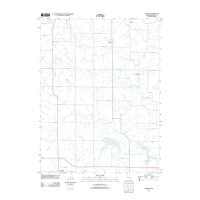
2012 Map of Fordham
USGS Topo · Published 2012About this map
Osborn sits at the southwestern edge of this DeKalb and Clinton County landscape, marking a transition from the structured residential grid of the town to the expansive agricultural tracts of the Missouri countryside. The area is defined by a dense network of country roads, such as SE Grindstone Rd and SE Wamsley Rd, which weave around numerous small water bodies including B-21 Lake and A-27 Lake.
Find a feature on this map
43 named features on this map. Tap any name to fly to it.
Don’t see what you’re looking for? This feature index may not catch every label — zoom into the map to look around manually.
Map Details
Editions of this 2012 Fordham Map
This is the sole edition of this map. No revisions or reprints were ever made.
Other maps of this area

1923 · Maysville
USGS Topo · 1:62,500

1924 · Polo
USGS Topo · 1:62,500

1924 · Winston
USGS Topo · 1:62,500

1925 · Plattsburg
USGS Topo · 1:62,500

1925 · Maysville
USGS Topo · 1:62,500

1950 · Kansas City
USGS Topo · 1:250,000

1954 · Kansas City
USGS Topo · 1:250,000

1956 · Kansas City
USGS Topo · 1:250,000

1960 · Kansas City
USGS Topo · 1:250,000
1983 · Maysville
USGS Topo · 1:24,000