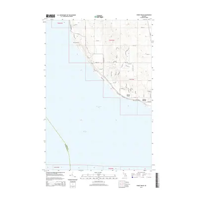
2014 Map of Forest Beach
USGS Topo · Published 2014About this map
Little Traverse Bay defines the southwestern edge of this landscape, where the waters of Lake Michigan meet a shoreline dotted with residential development and natural points. The shoreline is punctuated by Sevenmile Point, a notable landform just north of where Fivemile Cr drains into the bay. In the southeastern corner, the settlement of Harbor Springs anchors the map, showing a transition from the structured street grid of the town to the wooded residential enclaves of Forest Beach.
Find a feature on this map
51 named features on this map. Tap any name to fly to it.
Don’t see what you’re looking for? This feature index may not catch every label — zoom into the map to look around manually.
Map Details
Editions of this 2014 Forest Beach Map
This is the sole edition of this map. No revisions or reprints were ever made.
Other maps of this area

1955 · Cheboygan
USGS Topo · 1:250,000

1958 · Cheboygan
USGS Topo · 1:250,000

1958 · Cross Village
USGS Topo · 1:62,500

1958 · Pellston
USGS Topo · 1:62,500

1958 · Bayshore
USGS Topo · 1:62,500

1958 · Petoskey
USGS Topo · 1:62,500

1975 · Petoskey NW
USGS Topo · 1:24,000

1975 · Petoskey SW
USGS Topo · 1:24,000

1982 · Petoskey
USGS Topo · 1:100,000
1982 · Good Hart
USGS Topo · 1:25,000