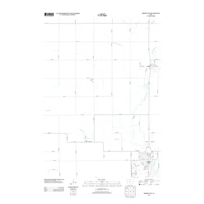
2013 Map of Forest City
USGS Topo · Published 2013About this map
Forest City serves as the primary hub of this North Central Iowa landscape, situated along the winding course of the Winnebago River. The city's grid is dense with residential streets and local connectors like W Broadway and E Broadway, reflecting its role as a regional center of commerce and residence in the early twenty-first century. North of the city, the smaller settlement of Leland is positioned near the river, surrounded by a highly organized grid of rural section roads such as 400th St and 150th Ave.
Find a feature on this map
75 named features on this map. Tap any name to fly to it.
Don’t see what you’re looking for? This feature index may not catch every label — zoom into the map to look around manually.
Map Details
Editions of this 2013 Forest City Map
This is the sole edition of this map. No revisions or reprints were ever made.
Other maps of this area

1954 · Mason City
USGS Topo · 1:250,000

1957 · Mason City
USGS Topo · 1:250,000

1958 · Mason City
USGS Topo · 1:250,000

1972 · Forest City
USGS Topo · 1:24,000

1972 · Buffalo Center NE
USGS Topo · 1:24,000

1972 · Hayfield
USGS Topo · 1:24,000

1972 · Crystal Lake
USGS Topo · 1:24,000

1972 · Pilot Knob
USGS Topo · 1:24,000

1972 · Vinje
USGS Topo · 1:24,000
1972 · Thompson
USGS Topo · 1:24,000