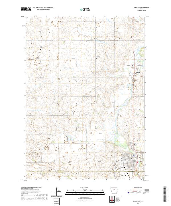
2022 Map of Forest City
USGS Topo · Published 2022About this map
Forest City serves as the focal point of this northern Iowa survey, situated along the Winnebago River near the border of Winnebago and Hancock Counties. The town center is marked by several key institutions, including the Winnebago County Courthouse and the campus of Waldorf College. Outside the primary settlement, the landscape transitions into a grid of rural roads and agricultural plots, punctuated by numerous local burial sites such as Oakland Cem and West Prairie Lutheran Cem. The terrain is defined by a network of waterways and managed drainage, featuring Buffalo Cr, Pike Run, and Drainage Ditch Number 14. To the north, the small community of Leland sits along the river, connected to the county seat by a straight corridor of transit. This map provides a clear view of the regional infrastructure, from the residential streets of the towns to the Blue Trail and outlying township boundaries.
Find a feature on this map
37 named features on this map. Tap any name to fly to it.
Don’t see what you’re looking for? This feature index may not catch every label — zoom into the map to look around manually.
Map Details
Editions of this 2022 Forest City Map
This is the sole edition of this map. No revisions or reprints were ever made.
Other maps of this area

1954 · Mason City
USGS Topo · 1:250,000

1957 · Mason City
USGS Topo · 1:250,000

1958 · Mason City
USGS Topo · 1:250,000

1972 · Forest City
USGS Topo · 1:24,000

1972 · Buffalo Center NE
USGS Topo · 1:24,000

1972 · Hayfield
USGS Topo · 1:24,000

1972 · Crystal Lake
USGS Topo · 1:24,000

1972 · Pilot Knob
USGS Topo · 1:24,000

1972 · Vinje
USGS Topo · 1:24,000
1972 · Thompson
USGS Topo · 1:24,000