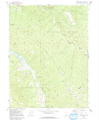
1979 Map of Forest Glen
USGS Topo · Published 1991About this map
Forest Glen serves as a central point of activity in this high-elevation landscape, situated where the South Fork Trinity River meets Rattlesnake Creek. The terrain is defined by its remote outpost character, featuring a Forest Service Sta and several established campgrounds like Fern Campground and Pickett Pk Campground. A solitary Grave near Taylor Flat and the Hell Gate passage suggest the difficult transit through these mountains before modern infrastructure.
Find a feature on this map
65 named features on this map. Tap any name to fly to it.
Don’t see what you’re looking for? This feature index may not catch every label — zoom into the map to look around manually.
Map Details
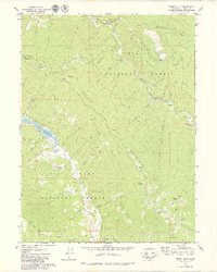
Editions of this 1979 Forest Glen Map
2 editions found
Other maps of this area

1918 · Anada
USGS Topo · 1:62,500

1921 · Hoaglin
USGS Topo · 1:62,500

1922 · Island Mountain
USGS Topo · 1:62,500

1931 · Hoaglin
USGS Topo · 1:96,000

1935 · Hoaglin
USGS Topo · 1:125,000

1953 · Blackrock Mtn
USGS Topo · 1:62,500

1954 · Pickett Peak
USGS Topo · 1:62,500

1954 · Dubakella Mtn
USGS Topo · 1:62,500

1954 · Blackrock Mtn
USGS Topo · 1:62,500
1955 · Kettenpom
USGS Topo · 1:62,500