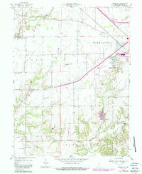
1958 Map of Forest Hill
USGS Topo · Published 1988About this map
Harris City and the surrounding townships of Clay, Washington, and Sand Creek reveal a landscape defined by 19th-century transit and rural community centers. While Greensburg serves as the regional anchor to the northeast, complete with the Greensburg-Decatur Co Airport and Fairgrounds, the map documents several smaller crossroads that served local farmers. The legacy of steam-era transportation is evident in the Vandalia Railroad and an Old Railroad Grade that cuts across the countryside near Horace. This 1958 survey, updated with late-20th-century photorevisions, preserves the location of numerous family burial grounds and country parishes, such as Mowery Cem, Columbus Cem, and Liberty Ch. Drainage follows the winding paths of Clifty Creek and Sand Creek, which carve through the otherwise orderly grid of Indiana farmstead roads.
Find a feature on this map
35 named features on this map. Tap any name to fly to it.
Don’t see what you’re looking for? This feature index may not catch every label — zoom into the map to look around manually.
Map Details
Editions of this 1958 Forest Hill Map
4 editions found
Other maps of this area

1942 · Columbus
USGS Topo · 1:125,000

1953 · Cincinnati
USGS Topo · 1:250,000

1956 · Waldron
USGS Topo · 1:24,000

1957 · Cincinnati
USGS Topo · 1:250,000

1958 · Greensburg
USGS Topo · 1:24,000

1958 · Millhousen
USGS Topo · 1:24,000

1958 · Westport
USGS Topo · 1:24,000

1958 · Forest Hill
USGS Topo · 1:24,000

1958 · Hartsville
USGS Topo · 1:24,000

1958 · Grammer
USGS Topo · 1:24,000