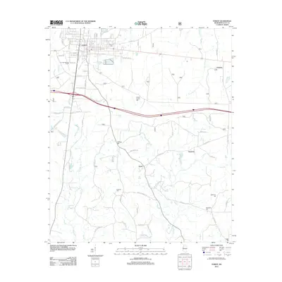
2012 Map of Forest
USGS Topo · Published 2012About this map
Forest serves as the central hub of this Scott County landscape, where urban streets like Iberville St and Front St meet the surrounding timber and agricultural lands. The terrain is defined by a series of prominent rises including Mathes Hill, Sherman Hill, and the distinctive Harrell Prairie Hill. Significant watercourses such as the Leaf River, Tallabogue, and Hontokalo Cr weave through the countryside, influencing the placement of smaller settlements like Norris and Fikestown. Genealogists and local researchers will find value in the documentation of the Eastern Cem and Gatewood Cem, alongside aviation landmarks like the G. V. Montgomery Airport. The map reflects a modern rural network where old routes like Old Hwy 35 and Zion Church Rd connect long-standing communities and family-named landmarks across the Mississippi interior.
Find a feature on this map
76 named features on this map. Tap any name to fly to it.
Don’t see what you’re looking for? This feature index may not catch every label — zoom into the map to look around manually.
Map Details
Editions of this 2012 Forest Map
This is the sole edition of this map. No revisions or reprints were ever made.
Other maps of this area

1921 · Forest
USGS Topo · 1:48,000

1922 · Forest
USGS Topo · 1:62,500

1922 · Morton
USGS Topo · 1:48,000

1924 · Morton
USGS Topo · 1:62,500

1950 · Forest
USGS Topo · 1:62,500

1951 · Morton
USGS Topo · 1:62,500

1952 · Forest
USGS Topo · 1:62,500

1953 · Meridian
USGS Topo · 1:250,000

1957 · Meridian
USGS Topo · 1:250,000

1965 · Meridian
USGS Topo · 1:250,000