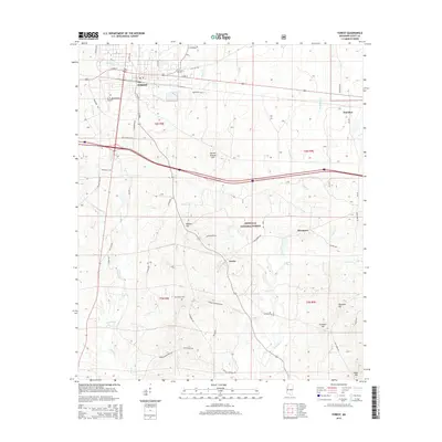
2015 Map of Forest
USGS Topo · Published 2015About this map
Forest serves as the central hub of this Scott County landscape, where the intersection of Old Hwy 80 and local routes like S Main St anchors the community's growth. To the south and east, the map reveals the transition from the municipal grid into the protected woodlands of the Bienville National Forest. This area is characterized by a series of named elevations including Harrell Prairie Hill, Mathes Hill, and Sherman Hill, which divide the various drainage basins of the Leaf River and its tributaries such as Jones Cr and Hontokalo Cr. Small outlying settlements like Norris, Fikestown, and Donohoe appear as pockets of development along secondary roads. Genealogists will find the locations of Eastern Cem and Gatewood Cem particularly useful for tracing local family roots in the rural areas surrounding the town center.
Find a feature on this map
59 named features on this map. Tap any name to fly to it.
Don’t see what you’re looking for? This feature index may not catch every label — zoom into the map to look around manually.
Map Details
Editions of this 2015 Forest Map
This is the sole edition of this map. No revisions or reprints were ever made.
Other maps of this area

1921 · Forest
USGS Topo · 1:48,000

1922 · Forest
USGS Topo · 1:62,500

1922 · Morton
USGS Topo · 1:48,000

1924 · Morton
USGS Topo · 1:62,500

1950 · Forest
USGS Topo · 1:62,500

1951 · Morton
USGS Topo · 1:62,500

1952 · Forest
USGS Topo · 1:62,500

1953 · Meridian
USGS Topo · 1:250,000

1957 · Meridian
USGS Topo · 1:250,000

1965 · Meridian
USGS Topo · 1:250,000