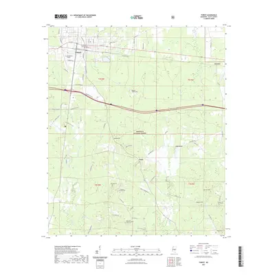
2021 Map of Forest
USGS Topo · Published 2021About this map
Forest serves as the focal point of this Scott County survey, centered on the Scott County Courthouse and its surrounding grid of streets like W Oak St and N Broad St. The landscape transitions quickly from the municipal center to the wooded expanses of the Bienville National Forest, which dominates the southern half of the quadrangle. Significant family and community history is anchored in the numerous rural burial grounds and places of worship, such as the Mount Zion Missionary Baptist Church and Hopewell Cem.
Find a feature on this map
76 named features on this map. Tap any name to fly to it.
Don’t see what you’re looking for? This feature index may not catch every label — zoom into the map to look around manually.
Map Details
Editions of this 2021 Forest Map
This is the sole edition of this map. No revisions or reprints were ever made.
Other maps of this area

1921 · Forest
USGS Topo · 1:48,000

1922 · Forest
USGS Topo · 1:62,500

1922 · Morton
USGS Topo · 1:48,000

1924 · Morton
USGS Topo · 1:62,500

1950 · Forest
USGS Topo · 1:62,500

1951 · Morton
USGS Topo · 1:62,500

1952 · Forest
USGS Topo · 1:62,500

1953 · Meridian
USGS Topo · 1:250,000

1957 · Meridian
USGS Topo · 1:250,000

1965 · Meridian
USGS Topo · 1:250,000