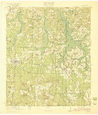
1922 Map of Forest
USGS Topo · Published 1922About this map
Forest serves as the central hub of this 1920s Scott County landscape, where the Alabama and Vicksburg Rt cuts a straight east-west line through the terrain. The map reveals a deeply established network of rural community centers, particularly noteworthy for the Patrons Union Campground and numerous family-named settlements like Singleton Settlement and Buckleytown.
Find a feature on this map
78 named features on this map. Tap any name to fly to it.
Don’t see what you’re looking for? This feature index may not catch every label — zoom into the map to look around manually.
Map Details
Editions of this 1922 Forest Map
2 editions found
Other maps of this area

1921 · Forest
USGS Topo · 1:48,000

1922 · Forest
USGS Topo · 1:62,500

1922 · Morton
USGS Topo · 1:48,000

1924 · Morton
USGS Topo · 1:62,500

1950 · Forest
USGS Topo · 1:62,500

1951 · Morton
USGS Topo · 1:62,500

1952 · Forest
USGS Topo · 1:62,500

1953 · Meridian
USGS Topo · 1:250,000

1957 · Meridian
USGS Topo · 1:250,000

1961 · Carthage
USGS Topo · 1:62,500