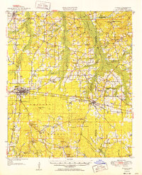
1952 Map of Forest
USGS Topo · Published 1952About this map
Bienville National Forest dominates this landscape in central Mississippi, where public lands intertwine with established family settlements and rural congregations. The seat of Scott County at Forest serves as a primary hub, situated along the Illinois Central Railroad and a prominent Gas Pipe Line that traverses the region. To the east, the village of Lake sits near the border of Newton County, surrounded by smaller agrarian outposts like Singleton Settlement, Usrytown, and Dennis Settlement.
Find a feature on this map
86 named features on this map. Tap any name to fly to it.
Don’t see what you’re looking for? This feature index may not catch every label — zoom into the map to look around manually.
Map Details
Editions of this 1952 Forest Map
2 editions found
Other maps of this area

1921 · Forest
USGS Topo · 1:48,000

1922 · Forest
USGS Topo · 1:62,500

1922 · Morton
USGS Topo · 1:48,000

1924 · Morton
USGS Topo · 1:62,500

1950 · Forest
USGS Topo · 1:62,500

1951 · Morton
USGS Topo · 1:62,500

1952 · Forest
USGS Topo · 1:62,500

1953 · Meridian
USGS Topo · 1:250,000

1957 · Meridian
USGS Topo · 1:250,000

1961 · Carthage
USGS Topo · 1:62,500