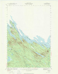
1940 Map of Forest
USGS Topo · Published 1984About this map
Vanceboro and Forest City serve as the primary gateways along the international border in this 1940 survey of eastern Washington County. The landscape is defined by the expansive waters of the St Croix River and Chiputneticook Lakes, which form the boundary between Maine and New Brunswick. Vital transportation corridors including the Maine Central and Canadian Pacific railroads cross the region, connecting isolated settlements like Lambert Lake to the broader rail network of the era.
Find a feature on this map
61 named features on this map. Tap any name to fly to it.
Don’t see what you’re looking for? This feature index may not catch every label — zoom into the map to look around manually.
Map Details
Editions of this 1940 Forest Map
3 editions found
Other maps of this area

1930 · Vanceboro
USGS Topo · 1:48,000

1933 · Vanceboro
USGS Topo · 1:62,500

1940 · Danforth
USGS Topo · 1:62,500

1940 · Amity
USGS Topo · 1:62,500

1940 · Waite
USGS Topo · 1:62,500

1940 · Forest
USGS Topo · 1:62,500

1940 · Kellyland
USGS Topo · 1:62,500

1941 · Danforth
USGS Topo · 1:62,500

1941 · Amity
USGS Topo · 1:62,500

1941 · Scraggly Lake
USGS Topo · 1:62,500