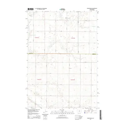
2015 Map of Forestburg NE
USGS Topo · Published 2015About this map
Bonny Cem sits as a quiet landmark amidst the prairie landscape of Floyd Township, where the boundary between Beadle and Sanborn Counties bisects the terrain. This survey reflects the modern agricultural grid of eastern South Dakota, defined by a regular network of section-line roads like 217th St and 225th St. Water plays a central role in the geography here, with the James River and its various tributaries including Pearl Cr, Marsh Cr, and Stony Run carving shallow paths through the plains. The presence of the Ingle Airport suggests the continued importance of regional aviation in these rural townships. The map serves as a clear record of the section, range, and township divisions that have organized this territory since the initial land surveys, documenting the persistent rural character of the Sanborn County countryside.
Find a feature on this map
22 named features on this map. Tap any name to fly to it.
Don’t see what you’re looking for? This feature index may not catch every label — zoom into the map to look around manually.
Map Details
Editions of this 2015 Forestburg NE Map
This is the sole edition of this map. No revisions or reprints were ever made.
Other maps of this area

1898 · Huron
USGS Topo · 1:125,000

1899 · De Smet
USGS Topo · 1:125,000

1953 · Huron
USGS Topo · 1:250,000

1953 · Watertown
USGS Topo · 1:250,000

1954 · Huron
USGS Topo · 1:250,000

1957 · Forestburg NE
USGS Topo · 1:24,000
1957 · Forestburg
USGS Topo · 1:24,000

1957 · Cavour
USGS Topo · 1:24,000

1957 · Huron
USGS Topo · 1:24,000

1958 · Watertown
USGS Topo · 1:250,000