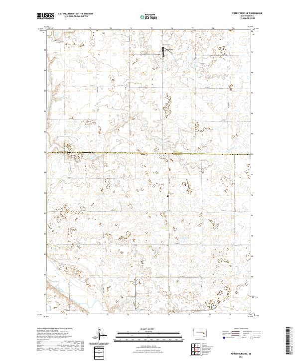
2021 Map of Forestburg NE
USGS Topo · Published 2021About this map
The James River meanders through the southwestern corner of this agricultural landscape on the border of Beadle and Sanborn counties. This prairie terrain is defined by an intricate network of drainage ways and seasonal wetlands, including Marsh Creek, Stony Run, and the South Fork Pearl Creek. While primarily rural, the map identifies local landmarks such as Ingle Airport near the northern boundary and the Bonny Cemetery located centrally along 222nd Street. The strictly rectilinear road grid, composed of routes like Miner Country Lane and County Road 12, reveals the enduring influence of the Public Land Survey System on South Dakota's modern settlement patterns, where section lines dictate the movement across the open plains.
Find a feature on this map
23 named features on this map. Tap any name to fly to it.
Don’t see what you’re looking for? This feature index may not catch every label — zoom into the map to look around manually.
Map Details
Editions of this 2021 Forestburg NE Map
This is the sole edition of this map. No revisions or reprints were ever made.
Other maps of this area

1898 · Huron
USGS Topo · 1:125,000

1899 · De Smet
USGS Topo · 1:125,000

1953 · Huron
USGS Topo · 1:250,000

1953 · Watertown
USGS Topo · 1:250,000

1954 · Huron
USGS Topo · 1:250,000

1957 · Forestburg NE
USGS Topo · 1:24,000
1957 · Forestburg
USGS Topo · 1:24,000

1957 · Cavour
USGS Topo · 1:24,000

1957 · Huron
USGS Topo · 1:24,000

1958 · Watertown
USGS Topo · 1:250,000