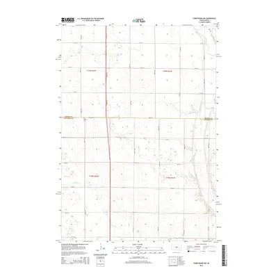
2015 Map of Forestburg NW
USGS Topo · Published 2015About this map
The James River meanders along the eastern edge of this prairie landscape, defining the boundary for much of the water-shaped terrain in this region of South Dakota. In the northern reaches, Stony Run feeds into the main river channel, while Sand Cr flows through the southwestern portion of the map. This area is characterized by its organized grid of rural roads, including 400th Ave and 220th St, which trace the section lines of the Public Land Survey System. Located near the central boundary between Beadle and Sanborn Counties, the Aquilla Cem stands as a quiet focal point for local history and genealogical research in this agricultural expanse. The map illustrates a late 20th-century rural settlement pattern where traditional land divisions remained the primary structure for habitation and transit.
Find a feature on this map
24 named features on this map. Tap any name to fly to it.
Don’t see what you’re looking for? This feature index may not catch every label — zoom into the map to look around manually.
Map Details
Editions of this 2015 Forestburg NW Map
This is the sole edition of this map. No revisions or reprints were ever made.
Other maps of this area

1898 · Huron
USGS Topo · 1:125,000

1953 · Huron
USGS Topo · 1:250,000

1954 · Huron
USGS Topo · 1:250,000

1957 · Forestburg NE
USGS Topo · 1:24,000
1957 · Forestburg
USGS Topo · 1:24,000

1957 · Cavour
USGS Topo · 1:24,000

1957 · Huron
USGS Topo · 1:24,000

1958 · Forestburg NW
USGS Topo · 1:24,000

1973 · Alpena
USGS Topo · 1:24,000
1973 · Forestburg SW
USGS Topo · 1:24,000