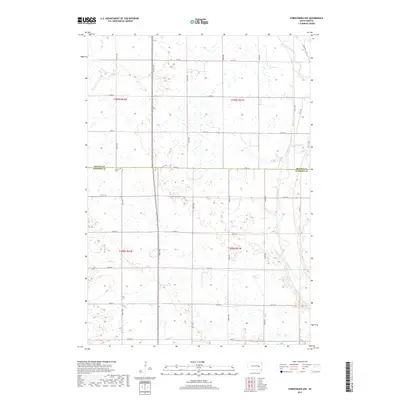
2017 Map of Forestburg NW
USGS Topo · Published 2017About this map
The James River snakes through the eastern portion of this prairie landscape, joined by tributaries including Stony Run and Sand Cr. This 2017 digital survey reveals a grid-patterned agricultural region divided by the Beadle Co Sanborn Co line. While the terrain is dominated by section lines and modern roads such as 220th St and 218th St, the presence of Aquilla Cem provides a specific point of interest for genealogists tracing local families in Warren Township. The topography is defined by numerous small depressions and wetland areas scattered throughout the townships of t109n r62w, t109n r61w, t108n r62w, and t108n r61w. This map captures the intersection of traditional land divisions and the natural hydrology of the James River valley.
Find a feature on this map
19 named features on this map. Tap any name to fly to it.
Don’t see what you’re looking for? This feature index may not catch every label — zoom into the map to look around manually.
Map Details
Editions of this 2017 Forestburg NW Map
This is the sole edition of this map. No revisions or reprints were ever made.
Other maps of this area

1898 · Huron
USGS Topo · 1:125,000

1953 · Huron
USGS Topo · 1:250,000

1954 · Huron
USGS Topo · 1:250,000

1957 · Forestburg NE
USGS Topo · 1:24,000
1957 · Forestburg
USGS Topo · 1:24,000

1957 · Cavour
USGS Topo · 1:24,000

1957 · Huron
USGS Topo · 1:24,000

1958 · Forestburg NW
USGS Topo · 1:24,000

1973 · Alpena
USGS Topo · 1:24,000
1973 · Forestburg SW
USGS Topo · 1:24,000