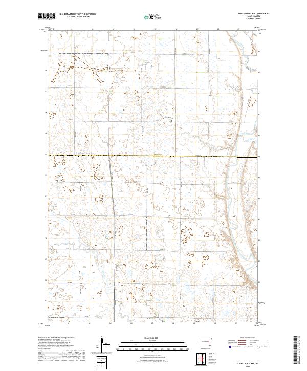
2021 Map of Forestburg NW
USGS Topo · Published 2021About this map
Aquilla Cem sits near the crossing of 220th St and 397th Ave, marking the boundary between Beadle and Sanborn Counties. This area of South Dakota is defined by its sectional road grid and the winding path of the James River, which cuts through the eastern portion of the landscape. Several smaller waterways, including Stony Run and Sand Cr, drain the surrounding prairie, illustrating the subtle hydrology of the region. The map preserves the precise township and range divisions, such as t109n r62w and t108n r61w, which continue to dictate the layout of rural farmsteads and county routes like Co Rd 12 well into the twenty-first century.
Find a feature on this map
19 named features on this map. Tap any name to fly to it.
Don’t see what you’re looking for? This feature index may not catch every label — zoom into the map to look around manually.
Map Details
Editions of this 2021 Forestburg NW Map
This is the sole edition of this map. No revisions or reprints were ever made.
Other maps of this area

1898 · Huron
USGS Topo · 1:125,000

1953 · Huron
USGS Topo · 1:250,000

1954 · Huron
USGS Topo · 1:250,000

1957 · Forestburg NE
USGS Topo · 1:24,000
1957 · Forestburg
USGS Topo · 1:24,000

1957 · Cavour
USGS Topo · 1:24,000

1957 · Huron
USGS Topo · 1:24,000

1958 · Forestburg NW
USGS Topo · 1:24,000

1973 · Alpena
USGS Topo · 1:24,000
1973 · Forestburg SW
USGS Topo · 1:24,000