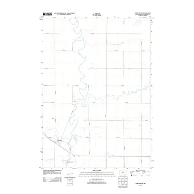
2012 Map of Forestburg
USGS Topo · Published 2012About this map
Forestburg stands as a central point of activity along the section lines of Sanborn County, where the grid of agricultural roads meets the winding path of the James River. This 2012 survey illustrates a landscape defined by the intersection of man-made drainage and natural watercourses, including the channel of County Ditch Number 14 and the curves of Redstone Cr. To the south, Ruskin Park occupies a bend in the river, while the solitary elevation of Big Mound rises above the surrounding plains to the north. The map details the local infrastructure of the era, from the intersection of Main St and Corliss Ave to the path of River Rd, providing a clear view of this rural South Dakota community's geography at the start of the twenty-first century.
Find a feature on this map
24 named features on this map. Tap any name to fly to it.
Don’t see what you’re looking for? This feature index may not catch every label — zoom into the map to look around manually.
Map Details
Editions of this 2012 Forestburg Map
This is the sole edition of this map. No revisions or reprints were ever made.
Other maps of this area

1898 · Huron
USGS Topo · 1:125,000

1899 · Mitchell
USGS Topo · 1:125,000

1899 · Alexandria
USGS Topo · 1:125,000

1899 · De Smet
USGS Topo · 1:125,000

1953 · Huron
USGS Topo · 1:250,000

1953 · Watertown
USGS Topo · 1:250,000

1954 · Huron
USGS Topo · 1:250,000

1955 · Sioux Falls
USGS Topo · 1:250,000

1955 · Mitchell
USGS Topo · 1:250,000

1957 · Forestburg NE
USGS Topo · 1:24,000