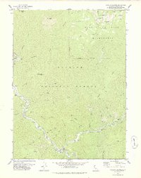
1978 Map of Forks of Salmon
USGS Topo · Published 1978About this map
Forks of Salmon sits at the critical confluence of the North Fork Salmon River and South Fork Salmon River, serving as a central hub for the surrounding gold mining and forest activity in the 1970s. The landscape is defined by its deep gulches and high ridges, where prospectors once worked claims like the Evergreen Mine, Sauerkraut Mine, and Codfish Hill Mine. Along the riverbanks, numerous gravel bars and flats, such as Fong Wah Bar and Brazille Flat, hint at the diverse history of placer mining in this corner of the Klamath National Forest.
Find a feature on this map
78 named features on this map. Tap any name to fly to it.
Don’t see what you’re looking for? This feature index may not catch every label — zoom into the map to look around manually.
Map Details
Editions of this 1978 Forks of Salmon Map
2 editions found
Other maps of this area

1948 · Weed
USGS Topo · 1:250,000

1950 · Weed
USGS Topo · 1:250,000

1955 · Salmon Mtn
USGS Topo · 1:62,500

1955 · Cecilville
USGS Topo · 1:62,500

1955 · Sawyers Bar
USGS Topo · 1:62,500

1955 · Forks of Salmon
USGS Topo · 1:62,500

1958 · Weed
USGS Topo · 1:250,000

1963 · Weed
USGS Topo · 1:250,000

1974 · Orleans Mtn.
USGS Topo · 1:24,000
1977 · English Peak
USGS Topo · 1:24,000