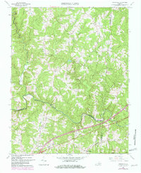
1966 Map of Forksville
USGS Topo · Published 1982About this map
The Meherrin River carves a winding path through this rural landscape at the intersection of Lunenburg, Brunswick, and Mecklenburg counties. During the mid-1960s, the region was defined by a sparse network of country roads connecting small centers like Bacons Fork and Gills Corner. To the south, the Seaboard Coast Line railroad runs parallel to the river, serving the community at Forksville (Skelton Station). Several historic river crossings are documented, including the Hawthorne High Bridge and Dix Bridge, which were vital for local transit between the disparate rural settlements.
Find a feature on this map
33 named features on this map. Tap any name to fly to it.
Don’t see what you’re looking for? This feature index may not catch every label — zoom into the map to look around manually.
Map Details
Editions of this 1966 Forksville Map
2 editions found
Other maps of this area

1918 · Lawrenceville
USGS Topo · 1:62,500

1919 · White Plains
USGS Topo · 1:48,000

1920 · Lawrenceville
USGS Topo · 1:48,000

1920 · White Plains
USGS Topo · 1:62,500

1921 · Lawrenceville
USGS Topo · 1:62,500

1942 · Lawrenceville
USGS Topo · 1:62,500
1951 · Danieltown
USGS Topo · 1:24,000

1953 · Norfolk
USGS Topo · 1:250,000

1953 · Greensboro
USGS Topo · 1:250,000

1954 · Greensboro
USGS Topo · 1:250,000