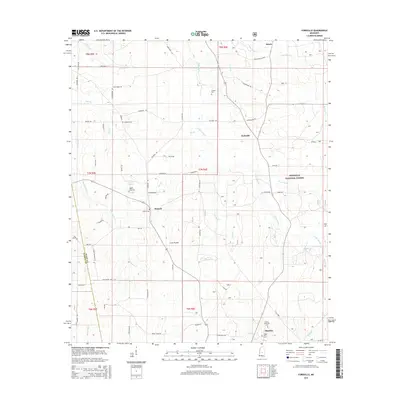
2015 Map of Forkville
USGS Topo · Published 2015About this map
Morton serves as the southern anchor for this Scott County landscape, where the edges of the Bienville National Forest meet a patchwork of rural homesteads and agricultural clearings. The terrain is characterized by its open spaces, including Bald Prairie and Line Prairie, which stand out amongst the dense creek networks. Waterways like Coffee Bogue, Hurricane Cr, and Cherry Cr drain the rolling geography, often flanked by family-named roads such as Billy Davis Rd and McCurdy Rd. This survey highlights the distribution of small communities like Forkville and Branch, alongside several local burying grounds including Latham Cem and Morton Memorial Cem. The intersection of established forest land and private holdings provides a clear view of the regional land use patterns near the Rankin and Scott county line.
Find a feature on this map
68 named features on this map. Tap any name to fly to it.
Don’t see what you’re looking for? This feature index may not catch every label — zoom into the map to look around manually.
Map Details
Editions of this 2015 Forkville Map
This is the sole edition of this map. No revisions or reprints were ever made.
Other maps of this area

1922 · Morton
USGS Topo · 1:48,000

1922 · Pelahatchee
USGS Topo · 1:48,000

1924 · Pelahatchee
USGS Topo · 1:62,500

1924 · Morton
USGS Topo · 1:62,500

1950 · Pelahatchie
USGS Topo · 1:62,500

1951 · Morton
USGS Topo · 1:62,500

1952 · Pelahatchie
USGS Topo · 1:62,500

1953 · Meridian
USGS Topo · 1:250,000

1957 · Meridian
USGS Topo · 1:250,000

1960 · Sharon
USGS Topo · 1:62,500