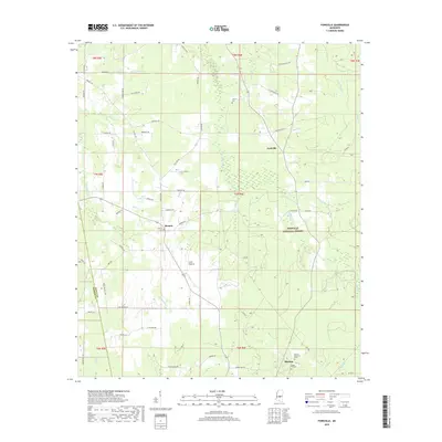
2018 Map of Forkville
USGS Topo · Published 2018About this map
The Bienville National Forest landscape in Scott County is defined by its transition between prairie clearings and winding creek bottoms. In this 2018 record, the distinctive Bald Prairie and Line Prairie areas stand out as geographic markers amidst the timberland. Local history is anchored by the northern settlement of Forkville and the community of Branch, while the southern edge of the map captures the northern outskirts of Morton. The terrain is deeply carved by a network of waterways including Sugar Bogue, Coffee Bogue, and Hurricane Creek, which historically dictated the placement of early homesteads and roads. For genealogists, the map preserves the locations of several burial grounds, such as Latham Cemetery and Liberty Cemetery, alongside family-named landmarks like D S Shoemaker Road and Hattie Wallace Road.
Find a feature on this map
70 named features on this map. Tap any name to fly to it.
Don’t see what you’re looking for? This feature index may not catch every label — zoom into the map to look around manually.
Map Details
Editions of this 2018 Forkville Map
This is the sole edition of this map. No revisions or reprints were ever made.
Other maps of this area

1922 · Morton
USGS Topo · 1:48,000

1922 · Pelahatchee
USGS Topo · 1:48,000

1924 · Pelahatchee
USGS Topo · 1:62,500

1924 · Morton
USGS Topo · 1:62,500

1950 · Pelahatchie
USGS Topo · 1:62,500

1951 · Morton
USGS Topo · 1:62,500

1952 · Pelahatchie
USGS Topo · 1:62,500

1953 · Meridian
USGS Topo · 1:250,000

1957 · Meridian
USGS Topo · 1:250,000

1960 · Sharon
USGS Topo · 1:62,500