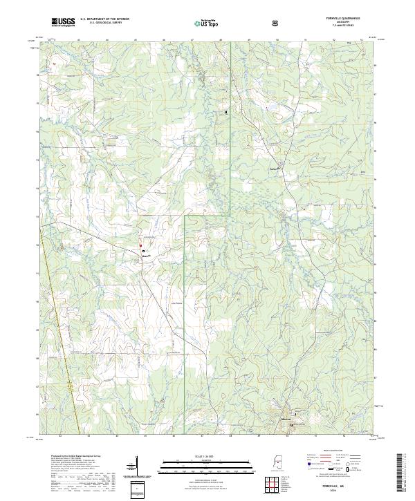
2024 Map of Forkville
USGS Topo · Published 2024About this map
Bienville National Forest dominates the eastern and southern portions of this landscape, where the headwaters of numerous creeks begin their descent through the central Mississippi woodlands. The settlement of Forkville serves as a local hub, situated amidst a network of rural roads such as D S Shoemaker Rd and Fairground Rd. To the south, the edge of Morton appears near the Rankin and Scott county line, anchored by the Morton Memorial Cem and Hodge Hill Cem. The terrain is defined by its drainage patterns, with Fannegusha Creek and Coffee Bogue carving through the lowlands. Smaller communities like Branch and Line Prairie are connected by a web of family-named thoroughfares, including M C Lum Rd and Thompson Rd, reflecting a deeply rooted rural settlement pattern that persists into the present day.
Find a feature on this map
79 named features on this map. Tap any name to fly to it.
Don’t see what you’re looking for? This feature index may not catch every label — zoom into the map to look around manually.
Map Details
Editions of this 2024 Forkville Map
This is the sole edition of this map. No revisions or reprints were ever made.
Other maps of this area

1922 · Morton
USGS Topo · 1:48,000

1922 · Pelahatchee
USGS Topo · 1:48,000

1924 · Pelahatchee
USGS Topo · 1:62,500

1924 · Morton
USGS Topo · 1:62,500

1950 · Pelahatchie
USGS Topo · 1:62,500

1951 · Morton
USGS Topo · 1:62,500

1952 · Pelahatchie
USGS Topo · 1:62,500

1953 · Meridian
USGS Topo · 1:250,000

1957 · Meridian
USGS Topo · 1:250,000

1960 · Sharon
USGS Topo · 1:62,500