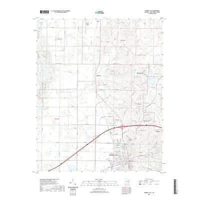
2020 Map of Forrest City
USGS Topo · Published 2020About this map
Forrest City serves as the focal point of this Eastern Arkansas landscape, positioned prominently as the seat of St. Francis County. The map details the civic heart of the community, anchored by the Saint Francis County Courthouse and supported by institutions like the East Arkansas Community College. The topography is defined by the unique elevation of Crowley Ridge, which rises above the surrounding Delta lowlands and influences the path of local waterways like Crow Creek and the L'Anguille River. To the north, the smaller settlements of Caldwell and Colt reflect the rural agricultural character of the region, while the Delta Regional Airport indicates the modern infrastructure connecting this part of the state. Genealogists will find a wealth of local landmarks, including several family and community burial sites such as Beazley Cem, Harris Cem, and the Mount Vernon Cem.
Find a feature on this map
131 named features on this map. Tap any name to fly to it.
Don’t see what you’re looking for? This feature index may not catch every label — zoom into the map to look around manually.
Map Details
Editions of this 2020 Forrest City Map
This is the sole edition of this map. No revisions or reprints were ever made.
Other maps of this area

1939 · Park Place
USGS Topo · 1:62,500

1939 · Wynne
USGS Topo · 1:62,500

1940 · Whitmore
USGS Topo · 1:62,500

1940 · Marianna
USGS Topo · 1:62,500

1948 · Helena
USGS Topo · 1:250,000

1950 · Helena
USGS Topo · 1:250,000

1953 · Memphis
USGS Topo · 1:250,000

1955 · Park Place
USGS Topo · 1:62,500

1955 · Helena
USGS Topo · 1:250,000

1956 · Memphis
USGS Topo · 1:250,000