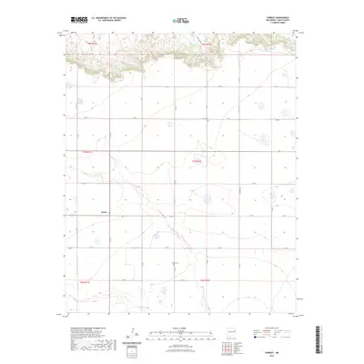
2023 Map of Forrest
USGS Topo · Published 2023About this map
Forrest stands as the primary settlement on this High Plains landscape, situated along the crossroads of QR 37 and Q R Ai. The map captures a largely agricultural and ranching environment defined by a grid of rural roads like Quay RD Ad and QR 41, which segment the terrain into townships and ranges. Two burial sites, Beevers Cem and Plain Cem, serve as important markers for family history and local genealogy in this corner of Quay County. The natural drainage of the land is traced by Frio Draw and Blanco Creek, which meander through the prairie, providing the only major topographic relief in an otherwise strictly organized system of land parcels.
Find a feature on this map
27 named features on this map. Tap any name to fly to it.
Don’t see what you’re looking for? This feature index may not catch every label — zoom into the map to look around manually.
Map Details
Editions of this 2023 Forrest Map
This is the sole edition of this map. No revisions or reprints were ever made.
Other maps of this area

1954 · Clovis
USGS Topo · 1:250,000

1957 · Hammond Ranch
USGS Topo · 1:62,500

1958 · Clovis
USGS Topo · 1:250,000

1971 · Ragland
USGS Topo · 1:24,000
1971 · Mesa Redonda
USGS Topo · 1:24,000
1971 · Apache Canyon
USGS Topo · 1:24,000
1971 · Norton
USGS Topo · 1:24,000

1971 · Grady SW
USGS Topo · 1:24,000

1971 · Forrest
USGS Topo · 1:24,000

1973 · Weber City
USGS Topo · 1:24,000