
1971 Map of Grady SW
USGS Topo · Published 1974About this map
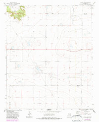
Puerto Canyon cuts through the mesa in the northwestern corner of this 1970s survey, where Puerto Creek drains toward the plains. This section of the High Plains near the Quay County and Curry County line is defined by a sparse ranching and industrial landscape, marked by a long Pipeline and scattered utility features. Near the small settlement of Watts, a lone Cemetery provides a focal point for genealogical research in this rural New Mexico landscape. The map captures the infrastructure of the era, including remote Landing Strips and a Water Tank positioned to serve the local agricultural or transport needs. Evidence of surface excavation is seen at several Gravel Pit locations, reflecting the local materials used for road building in this high-desert environment.
Find a feature on this map
9 named features on this map. Tap any name to fly to it.
Don’t see what you’re looking for? This feature index may not catch every label — zoom into the map to look around manually.
Map Details
Editions of this 1971 Grady SW Map
2 editions found
Other maps of this area

1954 · Clovis
USGS Topo · 1:250,000

1957 · Hammond Ranch
USGS Topo · 1:62,500

1958 · Clovis
USGS Topo · 1:250,000
1971 · Apache Canyon
USGS Topo · 1:24,000

1971 · Wheatland
USGS Topo · 1:24,000
1971 · Norton
USGS Topo · 1:24,000

1971 · Grady
USGS Topo · 1:24,000

1971 · Forrest
USGS Topo · 1:24,000
1973 · Field
USGS Topo · 1:24,000

1985 · Smith Ranch
USGS Topo · 1:24,000