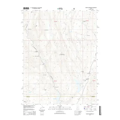
2014 Map of Forsyth Reservoir
USGS Topo · Published 2014About this map
Fishlake National Forest dominates this section of the High Plateaus, where the Fremont River carves through a landscape of deep canyons and expansive benches. The map reveals a complex hydraulic system vital to the region, centered on the Forsyth Reservoir and the Mill Meadow Reservoir near the border of Sevier and Wayne counties. Numerous canyons like Ivie Canyon, Splatter Canyon, and East Tidwell Canyon define the drainage patterns toward the river, while high-altitude features like Zedds Mtn and Zedds Meadows provide local landmarks for navigation. Smaller water sources, including Mamoits Spring and Toats Spring, are tucked into the drainages of Forsyth Valley. This 2014 survey documents the modern management of these watersheds and the forest service road network, including the Fremont River Rd, that provides access through the rugged Utah interior.
Find a feature on this map
40 named features on this map. Tap any name to fly to it.
Don’t see what you’re looking for? This feature index may not catch every label — zoom into the map to look around manually.
Map Details
Editions of this 2014 Forsyth Reservoir Map
This is the sole edition of this map. No revisions or reprints were ever made.
Other maps of this area

1885 · Fish Lake
USGS Topo · 1:250,000

1896 · Fish Lake
USGS Topo · 1:250,000

1922 · Emery No.3
USGS Topo · 1:31,680

1952 · Notom 2 NW
USGS Topo · 1:24,000

1952 · Torrey
USGS Topo · 1:62,500

1952 · Loa 1 NE
USGS Topo · 1:24,000

1956 · Salina
USGS Topo · 1:250,000

1960 · Salina
USGS Topo · 1:250,000

1962 · Salina
USGS Topo · 1:250,000

1967 · Lyman
USGS Topo · 1:24,000