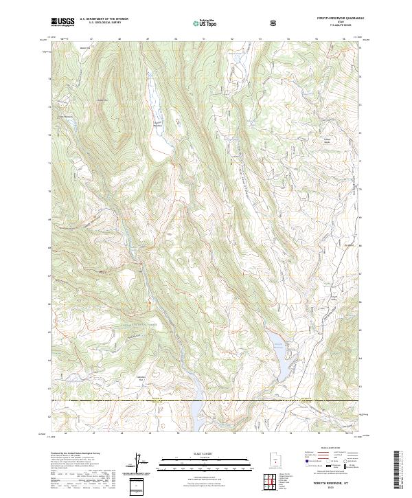
2023 Map of Forsyth Reservoir
USGS Topo · Published 2023About this map
Forsyth Reservoir and the Forsyth Dam anchor this high-elevation landscape within the Fishlake National Forest near the border of Sevier and Wayne counties. The drainage network is defined by the Fremont River and U M Creek, which wind through a complex system of plateaus and canyons including West Tidwell Canyon and Splatter Canyon. Named landmarks such as Zedds Mtn, Foy Bench, and Cedarless Flat highlight the distinctive terrain, while smaller water features like Tidwell Pond and Spring Reservoir dot the upland meadows. An extensive system of backcountry routes, such as the U M Creek Trl and Pole Canyon Trl, provides access to these remote reaches. This survey documents the modern infrastructure and recreation sites, including the Forsyth CG, in a region defined by its hydrographic management and forest service heritage.
Find a feature on this map
48 named features on this map. Tap any name to fly to it.
Don’t see what you’re looking for? This feature index may not catch every label — zoom into the map to look around manually.
Map Details
Editions of this 2023 Forsyth Reservoir Map
This is the sole edition of this map. No revisions or reprints were ever made.
Other maps of this area

1885 · Fish Lake
USGS Topo · 1:250,000

1896 · Fish Lake
USGS Topo · 1:250,000

1922 · Emery No.3
USGS Topo · 1:31,680

1952 · Notom 2 NW
USGS Topo · 1:24,000

1952 · Torrey
USGS Topo · 1:62,500

1952 · Loa 1 NE
USGS Topo · 1:24,000

1956 · Salina
USGS Topo · 1:250,000

1960 · Salina
USGS Topo · 1:250,000

1962 · Salina
USGS Topo · 1:250,000

1967 · Lyman
USGS Topo · 1:24,000