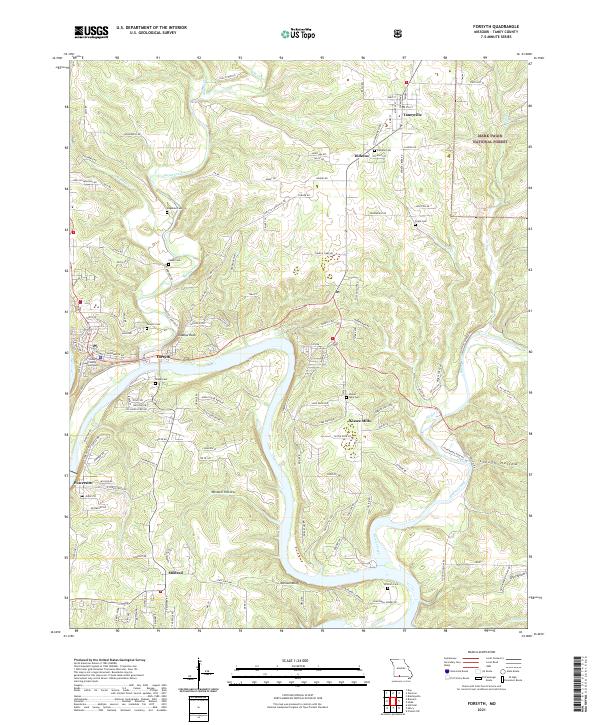
2021 Map of Forsyth
USGS Topo · Published 2021About this map
Forsyth serves as the focal point of this Taney County landscape, where the Taney County Courthouse stands near the winding course of Swan Creek. The map details a transition from the structured street grids of the county seat to the outlying settlements of Taneyville, Dickens, and Powersite. The topography is defined by significant bends in the river and deep drainage patterns like Wisdom Hollow and Slough Hollow.
Find a feature on this map
114 named features on this map. Tap any name to fly to it.
Don’t see what you’re looking for? This feature index may not catch every label — zoom into the map to look around manually.
Map Details
Editions of this 2021 Forsyth Map
This is the sole edition of this map. No revisions or reprints were ever made.
Other maps of this area

1907 · Forsyth
USGS Topo · 1:125,000

1937 · Bradleyville
USGS Topo · 1:48,000

1943 · Protem
USGS Topo · 1:62,500

1943 · Bradleyville
USGS Topo · 1:62,500

1945 · Harrison
USGS Topo · 1:250,000

1945 · Bradleyville
USGS Topo · 1:62,500

1949 · Harrison
USGS Topo · 1:250,000

1954 · Harrison
USGS Topo · 1:250,000

1955 · Garrison
USGS Topo · 1:24,000

1955 · Day
USGS Topo · 1:24,000