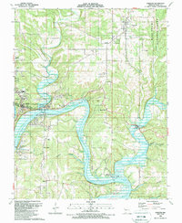
1989 Map of Forsyth
USGS Topo · Published 1989About this map
The White River and its massive impoundments dominate this late-twentieth-century landscape in Taney County. The confluence of Swan Creek and the river creates a wide basin at Forsyth, where the Shadow Rock Public Use Area and River Run Public Use Area serve as local hubs for river access. Downstream of the Ozark Beach Dam, the water transitions from Lake Taneycomo into the sprawling reaches of Bull Shoals Lake, characterized by large bends and landmarks like Johnson Bluff.
Find a feature on this map
46 named features on this map. Tap any name to fly to it.
Don’t see what you’re looking for? This feature index may not catch every label — zoom into the map to look around manually.
Map Details
Editions of this 1989 Forsyth Map
This is the sole edition of this map. No revisions or reprints were ever made.
Other maps of this area

1907 · Forsyth
USGS Topo · 1:125,000

1937 · Bradleyville
USGS Topo · 1:48,000

1943 · Protem
USGS Topo · 1:62,500

1943 · Bradleyville
USGS Topo · 1:62,500

1945 · Harrison
USGS Topo · 1:250,000

1945 · Bradleyville
USGS Topo · 1:62,500

1949 · Harrison
USGS Topo · 1:250,000

1954 · Harrison
USGS Topo · 1:250,000

1955 · Garrison
USGS Topo · 1:24,000

1955 · Day
USGS Topo · 1:24,000