
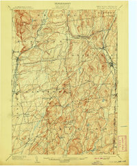
1904 Map of Fort Ann
USGS Topo · Published 1904About this map
Fort Ann serves as a focal point for this landscape along the New York Vermont Boundary Line, where the region's early industrial and transport networks are clearly defined. The Saratoga and Champlain Canal and the Delaware and Hudson RR cut through the western terrain, facilitating the movement of goods through the Wood Creek valley. To the east, the Mettawee River winds through slate-producing country, connecting settlements like Middle Granville and Slateville.
Find a feature on this map
64 named features on this map. Tap any name to fly to it.
Don’t see what you’re looking for? This feature index may not catch every label — zoom into the map to look around manually.
Map Details
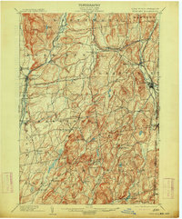
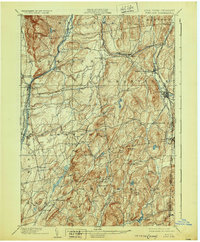
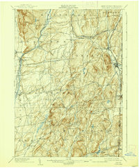
Editions of this 1904 Fort Ann Map
6 editions found

Other maps of this area

1893 · Fort Ann
USGS Topo · 1:62,500

1893 · Whitehall
USGS Topo · 1:62,500

1894 · Pawlet
USGS Topo · 1:62,500

1894 · Equinox
USGS Topo · 1:62,500

1895 · Whitehall
USGS Topo · 1:62,500

1895 · Cambridge
USGS Topo · 1:62,500

1895 · Fort Ann
USGS Topo · 1:62,500

1895 · Glens Falls
USGS Topo · 1:62,500

1895 · Castleton
USGS Topo · 1:62,500

1896 · Equinox
USGS Topo · 1:62,500