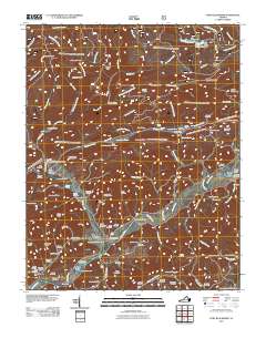
2011 Map of Fort Blackmore
USGS Topo · Published 2011About this map
Fort Blackmore and the surrounding Scott County landscape are defined by the winding course of the Clinch River as it passes through several steep ridges. The settlement of Wood and the nearby Pendleton Island anchor the southern portion of the map, while Stony Creek flows from the north to join the river at Fort Blackmore. The area is dense with family-named cemeteries and landmarks, reflecting a deeply rooted rural genealogy, including the Ballard Gillenwater Cemetery, Brickery Cemetery, and Laney Cemetery. Higher elevations like Buckner Ridge and Chimney Rock overlook narrow valleys such as Moping Hollow and Begley Hollow. A mix of recreation and infrastructure is present through features like Bark Camp Lake and the Buckner Ridge Lookout Tower. This survey provides a clear look at the region’s topography, from the Glenn Carter Memorial Bridge crossing to the remote paths around Negro Hollow and Mahogany Gap.
Find a feature on this map
112 named features on this map. Tap any name to fly to it.
Don’t see what you’re looking for? This feature index may not catch every label — zoom into the map to look around manually.
Map Details
Editions of this 2011 Fort Blackmore Map
This is the sole edition of this map. No revisions or reprints were ever made.
Other maps of this area

1894 · Estillville
USGS Topo · 1:125,000

1897 · Bristol
USGS Topo · 1:125,000

1902 · Bristol
USGS Topo · 1:125,000

1920 · Wise
USGS Topo · 1:48,000

1920 · Coeburn
USGS Topo · 1:48,000

1921 · Wise
USGS Topo · 1:62,500

1935 · Hilton
USGS Topo · 1:24,000
1935 · Wise
USGS Topo · 1:24,000

1935 · Moggasin
USGS Topo · 1:48,000
1935 · Norton
USGS Topo · 1:24,000