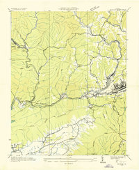
1935 Map of Norton
USGS Topo · Published 1935About this map
The coal industry dominates the rugged landscape of Wise County in the mid-1930s, where several mining operations and company towns define the social and economic structure. Active sites like Stonega Coal No 132 and Clinchfield Coal No 1 are connected by a dense network of rail lines, including the Interstate Railroad and the Louisville and Nashville Railroad. These tracks converge at significant junctions such as Dorchester Junction and Kent Junction, while an Inclined Tramway near Dunbar illustrates the engineering required to move coal across the steep terrain of Stone Mountain and Rogers Ridge.
Find a feature on this map
79 named features on this map. Tap any name to fly to it.
Don’t see what you’re looking for? This feature index may not catch every label — zoom into the map to look around manually.
Map Details
Editions of this 1935 Norton Map
This is the sole edition of this map. No revisions or reprints were ever made.
Other maps of this area

1890 · Whitesburg
USGS Topo · 1:125,000

1892 · Whitesburg
USGS Topo · 1:125,000

1894 · Estillville
USGS Topo · 1:125,000

1912 · Pound
USGS Topo · 1:48,000

1913 · Oven Fork
USGS Topo · 1:48,000

1914 · Pound
USGS Topo · 1:62,500

1915 · Whitesburg
USGS Topo · 1:62,500

1920 · Wise
USGS Topo · 1:48,000

1921 · Big Stone Gap
USGS Topo · 1:48,000

1921 · Wise
USGS Topo · 1:62,500