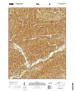
2019 Map of Fort Blackmore
USGS Topo · Published 2019About this map
Fort Blackmore serves as a focal point along the Clinch River, where the landscape transitions from the river valley to the steep ridges of the Jefferson National Forest. This region of Scott County is defined by its deep genealogical footprint, evidenced by dozens of family-named burial grounds like the Ballard Gillenwater Cem, Osborne Cem, and Stallard Cem. The map reveals a settlement pattern dictated by the topography, with communities like Wood, Lano, and Kerns clustered near water sources and gaps in the massive ridges. Notable terrain features such as Stone Mountain, Copper Ridge, and the distinct river bend at The Suck illustrate the complex geography that has shaped local transport and land use. Near the Glenn Carter Memorial Bridge, the proximity of Carter Chapel Cem and Methodist Camp Ln suggests a long-standing community center focused on the bend of Stony Cr.
Find a feature on this map
136 named features on this map. Tap any name to fly to it.
Don’t see what you’re looking for? This feature index may not catch every label — zoom into the map to look around manually.
Map Details
Editions of this 2019 Fort Blackmore Map
This is the sole edition of this map. No revisions or reprints were ever made.
Other maps of this area

1894 · Estillville
USGS Topo · 1:125,000

1897 · Bristol
USGS Topo · 1:125,000

1902 · Bristol
USGS Topo · 1:125,000

1920 · Wise
USGS Topo · 1:48,000

1920 · Coeburn
USGS Topo · 1:48,000

1921 · Wise
USGS Topo · 1:62,500

1935 · Hilton
USGS Topo · 1:24,000
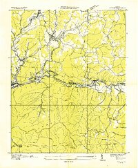
1935 · Wise
USGS Topo · 1:24,000

1935 · Moggasin
USGS Topo · 1:48,000
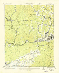
1935 · Norton
USGS Topo · 1:24,000