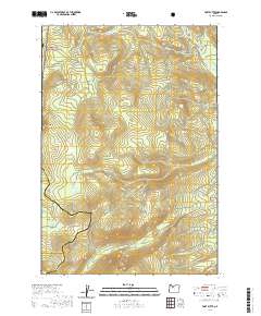
2020 Map of Fort Butte
USGS Topo · Published 2020About this map
The Pacific Crest National Scenic Trail winds through high-elevation terrain where the borders of Clackamas, Wasco, and Marion counties converge. Located within the Mount Hood National Forest, this 2020 survey documents a landscape of prominent peaks and alpine clearings. Significant landmarks include Ft Butte, North Pinhead Butte, and North Butte, which define the local topography alongside open expanses like Camas Prairie and Lemiti Meadow.
Find a feature on this map
42 named features on this map. Tap any name to fly to it.
Don’t see what you’re looking for? This feature index may not catch every label — zoom into the map to look around manually.
Map Details
Editions of this 2020 Fort Butte Map
This is the sole edition of this map. No revisions or reprints were ever made.
Other maps of this area

1924 · Mount Hood
USGS Topo · 1:125,000

1927 · Mount Hood
USGS Topo · 1:125,000

1927 · Mt. Jefferson
USGS Topo · 1:125,000

1930 · Mt. Jefferson
USGS Topo · 1:125,000

1953 · The Dalles
USGS Topo · 1:250,000

1955 · Bend
USGS Topo · 1:250,000

1956 · The Dalles
USGS Topo · 1:250,000

1956 · High Rock
USGS Topo · 1:62,500

1956 · Mt. Wilson
USGS Topo · 1:62,500

1957 · Bend
USGS Topo · 1:250,000