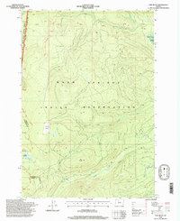
1996 Map of Fort Butte
USGS Topo · Published 1998About this map
The Warm Springs Indian Reservation and the Mount Hood National Forest meet in this high-elevation landscape of the Cascade Range. Marking the shared boundary, the Pacific Crest National Scenic Trail winds through the western portion of the map, providing a glimpse into the recreation and conservation patterns of the mid-1990s. The terrain is defined by volcanic features like Fort Butte and deposits of Lava, while numerous high-country marshes such as Camas Prairie, Warm Springs Meadow, and Lemiti Meadow dot the drainage basins.
Find a feature on this map
30 named features on this map. Tap any name to fly to it.
Don’t see what you’re looking for? This feature index may not catch every label — zoom into the map to look around manually.
Map Details
Editions of this 1996 Fort Butte Map
This is the sole edition of this map. No revisions or reprints were ever made.
Other maps of this area

1924 · Mount Hood
USGS Topo · 1:125,000

1927 · Mount Hood
USGS Topo · 1:125,000

1927 · Mt. Jefferson
USGS Topo · 1:125,000

1930 · Mt. Jefferson
USGS Topo · 1:125,000

1953 · The Dalles
USGS Topo · 1:250,000

1955 · Bend
USGS Topo · 1:250,000

1956 · The Dalles
USGS Topo · 1:250,000

1956 · High Rock
USGS Topo · 1:62,500

1956 · Mt. Wilson
USGS Topo · 1:62,500

1957 · Bend
USGS Topo · 1:250,000