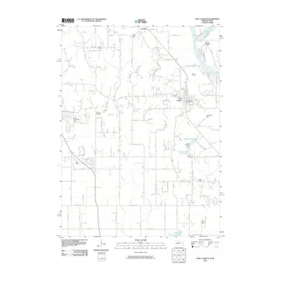
2010 Map of Fort Calhoun
USGS Topo · Published 2010About this map
The Missouri River defines the eastern boundary of this Nebraska landscape, where the historic settlement of Fort Calhoun serves as the primary hub of activity. The area is marked by a complex system of water management, evidenced by several detention structures and basins including Nixon Reservoir, Nelson Reservoir, and Lake Arrowhead. Genealogy and local history are anchored by the Pioneer Memorial Cemetery, while the northern portion of the quadrangle shows the small community of De Soto near the banks of DeSoto Lake. The topography is shaped by numerous seasonal and permanent waterways such as Little Papillion Creek and Turkey Creek that carve through the agricultural uplands. Evidence of regional infrastructure is visible through landmarks like the Bil Lo Airport and the Fort Calhoun Post Office, illustrating the intersection of rural residential growth and established river valley transport corridors during the early 21st century.
Find a feature on this map
48 named features on this map. Tap any name to fly to it.
Don’t see what you’re looking for? This feature index may not catch every label — zoom into the map to look around manually.
Map Details
Editions of this 2010 Fort Calhoun Map
This is the sole edition of this map. No revisions or reprints were ever made.
Other maps of this area

1893 · Omaha
USGS Topo · 1:62,500

1893 · Fremont
USGS Topo · 1:125,000

1896 · Fremont
USGS Topo · 1:125,000

1954 · Omaha
USGS Topo · 1:250,000

1955 · Fremont
USGS Topo · 1:250,000

1956 · Irvington
USGS Topo · 1:24,000

1956 · Omaha North
USGS Topo · 1:24,000

1957 · Fremont
USGS Topo · 1:250,000

1957 · Omaha
USGS Topo · 1:250,000

1957 · Loveland
USGS Topo · 1:24,000