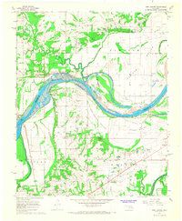
1967 Map of Fort Coffee
USGS Topo · Published 1968About this map
The Arkansas River meanders across this late 1960s landscape, marking the boundary between SequoyAH and Le Flore counties. This era captures a major transformation of the river valley as the W. D. Mayo Lock and Dam is shown under construction, with blue hatching indicating the areas soon to be submerged by its reservoir. The map preserves the locations of several important historical sites, including the Spiro Mound and the Site of Old Fort Coffee, overlooking the river from the south bank.
Find a feature on this map
41 named features on this map. Tap any name to fly to it.
Don’t see what you’re looking for? This feature index may not catch every label — zoom into the map to look around manually.
Map Details
Editions of this 1967 Fort Coffee Map
2 editions found
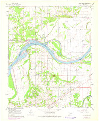
Other maps of this area

1879 · Fort Smith
USGS Topo · 1:62,500

1887 · Van Buren
USGS Topo · 1:62,500

1887 · Greenwood
USGS Topo · 1:62,500

1890 · Fort Smith
USGS Topo · 1:125,000

1900 · Sallisaw
USGS Topo · 1:125,000

1911 · Sallisaw
USGS Topo · 1:125,000

1943 · Fort Smith
USGS Topo · 1:125,000

1946 · Fort Smith
USGS Topo · 1:250,000

1947 · Van Buren
USGS Topo · 1:62,500

1947 · Greenwood
USGS Topo · 1:62,500