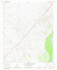
1961 Map of Fort Craig
USGS Topo · Published 1981About this map
The Fort Craig (Ruins) and the adjacent Fort Craig Cem serve as the historical anchor for this arid reach of the Rio Grande valley. This 1961 survey, with 1980 revisions, details a landscape shaped by both military history and water management. The massive Pedro Armendaris No 34 Grant Boundary cuts diagonally across the terrain, marking the persistent influence of Spanish and Mexican land grants on New Mexico’s geography. To the east, the Rio Grande Conveyance Channel and a series of silt fences illustrate the engineering efforts to control the river's flow near the Elephant Butte Reservoir Boundary. Ranching presence is noted at the George Birner Ranch, while the natural drainage system of Milligan Gulch and Quates Canyon defines the local topography.
Find a feature on this map
19 named features on this map. Tap any name to fly to it.
Don’t see what you’re looking for? This feature index may not catch every label — zoom into the map to look around manually.
Map Details
Editions of this 1961 Fort Craig Map
2 editions found
Other maps of this area

1948 · San Antonio
USGS Topo · 1:62,500

1948 · Val Verde
USGS Topo · 1:62,500

1954 · Tularosa
USGS Topo · 1:250,000

1958 · Tularosa
USGS Topo · 1:250,000

1961 · Hickman Ranch
USGS Topo · 1:24,000

1961 · Paraje Well
USGS Topo · 1:24,000

1961 · Black Hill
USGS Topo · 1:24,000

1961 · Fort Craig
USGS Topo · 1:24,000
1965 · Puertecito Gap
USGS Topo · 1:24,000
1965 · Cienega Ranch
USGS Topo · 1:24,000