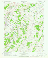
1964 Map of Fort Defiance
USGS Topo · Published 1973About this map
The Augusta Military Academy stands prominently near Fort Defiance, anchoring a landscape shaped by the deep meanders of the Middle River and its various tributaries in central Augusta County. This mid-century survey reflects a rural community connected by the Chesapeake Western railroad and punctuated by numerous local landmarks like the Drive-in Theater near Verona. The distribution of small settlements such as Knightly, Damtown, and Barren Ridge suggests a patchwork of agricultural homesteads and social centers tied to old parish foundations like the Augusta Stone Ch and Oak Grove Ch.
Find a feature on this map
40 named features on this map. Tap any name to fly to it.
Don’t see what you’re looking for? This feature index may not catch every label — zoom into the map to look around manually.
Map Details
Editions of this 1964 Fort Defiance Map
4 editions found
Other maps of this area

1892 · Harrisonburg
USGS Topo · 1:125,000

1894 · Staunton
USGS Topo · 1:125,000

1934 · Waynesboro
USGS Topo · 1:48,000

1939 · Waynesboro
USGS Topo · 1:62,500

1941 · Harrisonburg
USGS Topo · 1:62,500

1943 · Harrisonburg
USGS Topo · 1:62,500

1944 · Parnassus
USGS Topo · 1:62,500

1944 · Staunton
USGS Topo · 1:62,500

1947 · Staunton
USGS Topo · 1:62,500

1947 · Parnassus
USGS Topo · 1:62,500