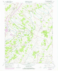
1964 Map of Fort Defiance
USGS Topo · Published 1978About this map
Fort Defiance serves as a primary anchor on this Augusta County sheet, where the grounds of the Augusta Military Academy and the Augusta Stone Ch stand near the Chesapeake Western railroad line. The landscape is defined by the winding course of the Middle River and its numerous tributaries, including Lewis Creek, Christians Creek, and Meadow Run. The settlement pattern follows these watercourses and ridges, linking small communities like Knightly, Damtown, and New Hope.
Find a feature on this map
42 named features on this map. Tap any name to fly to it.
Don’t see what you’re looking for? This feature index may not catch every label — zoom into the map to look around manually.
Map Details
Editions of this 1964 Fort Defiance Map
4 editions found
Other maps of this area

1892 · Harrisonburg
USGS Topo · 1:125,000

1894 · Staunton
USGS Topo · 1:125,000

1934 · Waynesboro
USGS Topo · 1:48,000

1939 · Waynesboro
USGS Topo · 1:62,500

1941 · Harrisonburg
USGS Topo · 1:62,500

1943 · Harrisonburg
USGS Topo · 1:62,500

1944 · Parnassus
USGS Topo · 1:62,500

1944 · Staunton
USGS Topo · 1:62,500

1947 · Staunton
USGS Topo · 1:62,500

1947 · Parnassus
USGS Topo · 1:62,500