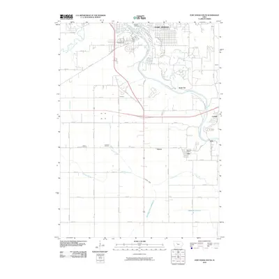
2010 Map of Fort Dodge South
USGS Topo · Published 2010About this map
The Des Moines River carves through the landscape south of Fort Dodge, anchoring a region shaped by industrial extraction and historic preservation. The presence of Gypsum deposits northeast of Shady Oak highlights the area's geological importance to local industry. Cultural heritage is centered at the Fort Museum and Frontier Village, while the surrounding rural landscape is dotted with small settlements like Coalville, Kalo, and Otho.
Find a feature on this map
54 named features on this map. Tap any name to fly to it.
Don’t see what you’re looking for? This feature index may not catch every label — zoom into the map to look around manually.
Map Details
Editions of this 2010 Fort Dodge South Map
This is the sole edition of this map. No revisions or reprints were ever made.
Other maps of this area

1923 · Lehigh
USGS Topo · 1:62,500

1923 · Fort Dodge
USGS Topo · 1:62,500

1954 · Fort Dodge
USGS Topo · 1:250,000

1957 · Fort Dodge
USGS Topo · 1:250,000

1958 · Fort Dodge
USGS Topo · 1:250,000

1965 · Moorland
USGS Topo · 1:24,000

1965 · Fort Dodge South
USGS Topo · 1:24,000

1965 · Lehigh
USGS Topo · 1:24,000

1965 · Gowrie
USGS Topo · 1:24,000

1965 · Harcourt
USGS Topo · 1:24,000