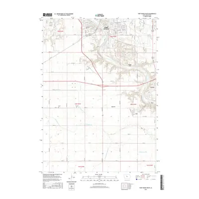
2015 Map of Fort Dodge South
USGS Topo · Published 2015About this map
The Des Moines River carves a deep valley through this portion of Webster County, shaping the development of Fort Dodge and its southern satellites. Along the river's eastern banks, the small settlements of Coalville, Kalo, and Otho are connected by a network of local roads that follow the winding topography. This area is characterized by a mix of educational hubs like the Iowa Central Community Coll campus and quiet, established communities such as Shady Oak and Roberts.
Find a feature on this map
106 named features on this map. Tap any name to fly to it.
Don’t see what you’re looking for? This feature index may not catch every label — zoom into the map to look around manually.
Map Details
Editions of this 2015 Fort Dodge South Map
This is the sole edition of this map. No revisions or reprints were ever made.
Other maps of this area

1923 · Lehigh
USGS Topo · 1:62,500

1923 · Fort Dodge
USGS Topo · 1:62,500

1954 · Fort Dodge
USGS Topo · 1:250,000

1957 · Fort Dodge
USGS Topo · 1:250,000

1958 · Fort Dodge
USGS Topo · 1:250,000

1965 · Moorland
USGS Topo · 1:24,000

1965 · Fort Dodge South
USGS Topo · 1:24,000

1965 · Lehigh
USGS Topo · 1:24,000

1965 · Gowrie
USGS Topo · 1:24,000

1965 · Harcourt
USGS Topo · 1:24,000