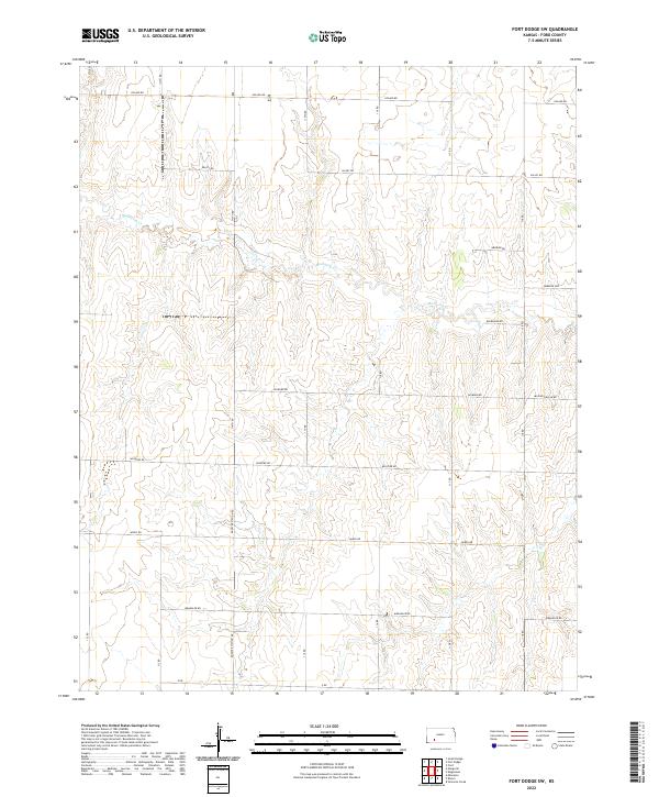
2022 Map of Fort Dodge SW
USGS Topo · Published 2022About this map
Mulberry Cr meanders across this rural section of Ford County, defining a landscape dominated by agriculture and a rigid section-line road network. The terrain is marked by significant names reflecting the character of the high plains, such as Whirlwind Rd and Wildfire Rd, which hint at the environmental forces common to the region. A notable industrial feature is Booster Station Rd, indicating the infrastructure supporting the transport of energy or water across these open reaches.
Find a feature on this map
29 named features on this map. Tap any name to fly to it.
Don’t see what you’re looking for? This feature index may not catch every label — zoom into the map to look around manually.
Map Details
Editions of this 2022 Fort Dodge SW Map
This is the sole edition of this map. No revisions or reprints were ever made.
Other maps of this area

1892 · Meade
USGS Topo · 1:125,000

1892 · Dodge
USGS Topo · 1:125,000

1892 · Spearville
USGS Topo · 1:125,000

1894 · Spearville
USGS Topo · 1:125,000

1896 · Ashland
USGS Topo · 1:125,000

1955 · Pratt
USGS Topo · 1:250,000

1955 · Dodge City
USGS Topo · 1:250,000

1958 · Dodge City
USGS Topo · 1:250,000

1959 · Pratt
USGS Topo · 1:250,000

1959 · Dodge City
USGS Topo · 1:250,000