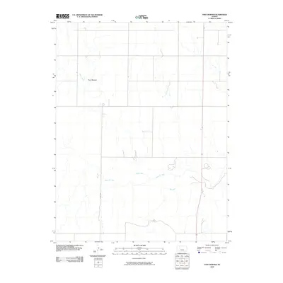
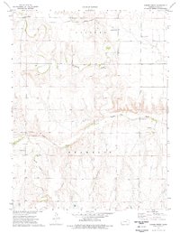
2009 Map of Fort Downer
USGS Topo · Published 2009About this map
Fort Downer marks the site of a historic frontier outpost on this high plains landscape in western Kansas. The terrain is defined by the winding course of the Smoky Hill River, which cuts across the southern portion of the area. This river valley, joined by tributaries such as Downer Creek and Sand Creek, creates a distinct hydrological pattern against the surrounding prairie. While the military station that once guarded the Smoky Hill Trail is the primary namesake, the modern layout is shaped by long-established section lines and infrastructure. Co Rd 533 and Highway 283 provide the primary north-south passage through Trego County, connecting the remote drainage basins and ranch lands that continue to characterize this region of the Great Plains.
Find a feature on this map
6 named features on this map. Tap any name to fly to it.
Don’t see what you’re looking for? This feature index may not catch every label — zoom into the map to look around manually.
Map Details
Editions of this 2009 Fort Downer Map
This is the sole edition of this map. No revisions or reprints were ever made.
Other maps of this area

1893 · Ellis
USGS Topo · 1:125,000

1955 · Great Bend
USGS Topo · 1:250,000

1955 · Scott City
USGS Topo · 1:250,000

1957 · Great Bend
USGS Topo · 1:250,000

1958 · Great Bend
USGS Topo · 1:250,000

1958 · Scott City
USGS Topo · 1:250,000
1960 · Trego Center
USGS Topo · 1:24,000
1960 · Trego Center NE
USGS Topo · 1:24,000
1972 · Castle Rock NE
USGS Topo · 1:24,000
1974 · Gibson Creek
USGS Topo · 1:24,000