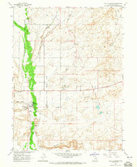
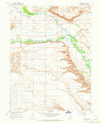
1964 Map of Fort Duchesne
USGS Topo · Published 1965About this map
Fort Duchesne serves as the focal point of this mid-1960s study, situated within the Uintah and Ouray Indian Reservation. The map details the administrative and communal infrastructure of the area, including the Indian Agency Hdqrs and the Uintah and Ouray Indian Cem. The landscape is defined by an intricate network of irrigation and water management features necessary for the arid climate, such as the Moffat Canal, Ouray Park Canal, and several instances of a Siphon and Flume used to transport water across the terrain.
Find a feature on this map
27 named features on this map. Tap any name to fly to it.
Don’t see what you’re looking for? This feature index may not catch every label — zoom into the map to look around manually.
Map Details
Editions of this 1964 Fort Duchesne Map
This is the sole edition of this map. No revisions or reprints were ever made.
Other maps of this area

1885 · Ashley
USGS Topo · 1:250,000

1917 · Vernal
USGS Topo · 1:125,000

1954 · Vernal
USGS Topo · 1:250,000

1958 · Vernal
USGS Topo · 1:250,000

1960 · Vernal
USGS Topo · 1:250,000

1964 · Lapoint
USGS Topo · 1:24,000
1964 · Whiterocks
USGS Topo · 1:24,000
1964 · Windy Ridge
USGS Topo · 1:24,000
1964 · Vernal SW
USGS Topo · 1:24,000
1964 · Randlett
USGS Topo · 1:24,000