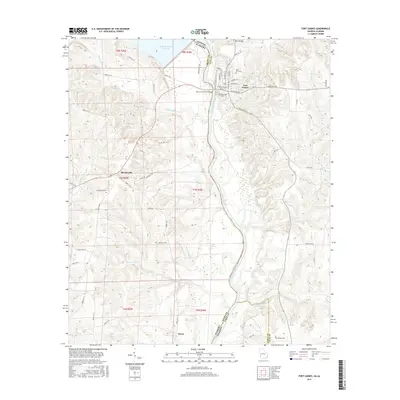
2017 Map of Fort Gaines
USGS Topo · Published 2017About this map
The Chattahoochee River defines the state boundary on this 2017 study, where the town of Fort Gaines sits on the Georgia bank overlooking the Walter F George Reservoir. The landscape transitions from the developed streets of the town center—including Commerce St and Hartford Rd—to the drainage basins of McRae Mill Cr and Bennett Mill Cr in Alabama.
Find a feature on this map
69 named features on this map. Tap any name to fly to it.
Don’t see what you’re looking for? This feature index may not catch every label — zoom into the map to look around manually.
Map Details
Editions of this 2017 Fort Gaines Map
This is the sole edition of this map. No revisions or reprints were ever made.
Other maps of this area

1953 · Dothan
USGS Topo · 1:250,000

1954 · Dothan
USGS Topo · 1:250,000

1955 · Dothan
USGS Topo · 1:250,000

1969 · Fort Gaines
USGS Topo · 1:24,000

1969 · Fort Gaines NW
USGS Topo · 1:24,000

1969 · Fort Gaines NE
USGS Topo · 1:24,000

1969 · Abbeville East
USGS Topo · 1:24,000

1970 · Columbia NE
USGS Topo · 1:24,000

1970 · Haleburg
USGS Topo · 1:24,000
1973 · Coleman
USGS Topo · 1:24,000