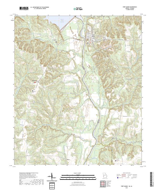
2024 Map of Fort Gaines
USGS Topo · Published 2024About this map
Fort Gaines occupies the high ground on the Georgia side of the Chattahoochee River, serving as a focal point for this borderland geography. The landscape is defined by the massive Walter F George Lock and Dam and the expansive Walter F George Reservoir, which reshape the river's path northward. This modern survey illustrates the complex drainage network feeding into the river, including McRae Mill Creek and Town Branch near the town center.
Find a feature on this map
75 named features on this map. Tap any name to fly to it.
Don’t see what you’re looking for? This feature index may not catch every label — zoom into the map to look around manually.
Map Details
Editions of this 2024 Fort Gaines Map
This is the sole edition of this map. No revisions or reprints were ever made.
Other maps of this area

1953 · Dothan
USGS Topo · 1:250,000

1954 · Dothan
USGS Topo · 1:250,000

1955 · Dothan
USGS Topo · 1:250,000

1969 · Fort Gaines
USGS Topo · 1:24,000

1969 · Fort Gaines NW
USGS Topo · 1:24,000

1969 · Fort Gaines NE
USGS Topo · 1:24,000

1969 · Abbeville East
USGS Topo · 1:24,000

1970 · Columbia NE
USGS Topo · 1:24,000

1970 · Haleburg
USGS Topo · 1:24,000
1973 · Coleman
USGS Topo · 1:24,000