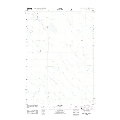
2012 Map of Fort George Butte
USGS Topo · Published 2012About this map
Fort George Butte dominates this prairie landscape in Lyman County, rising above a network of seasonal watercourses and drainage basins. The area is defined by its drainage pattern, with Fort George Cr and LaRoche Cr cutting through the northern reaches, while Plum Cr and Cedar Cr cross the southern sections. This 2012 survey illustrates the modern rural infrastructure of the region, where a rectilinear grid of section-line roads, such as 303rd Ave and 221st St, provides access through the open terrain. The mapping reflects the sparse settlement of this part of South Dakota, showing how geography and water access like Straight Cr and Timber Cr historically shaped the movement across these plains.
Find a feature on this map
13 named features on this map. Tap any name to fly to it.
Don’t see what you’re looking for? This feature index may not catch every label — zoom into the map to look around manually.
Map Details
Editions of this 2012 Fort George Butte Map
This is the sole edition of this map. No revisions or reprints were ever made.
Other maps of this area

1934 · Canning
USGS Topo · 1:48,000

1937 · Canning
USGS Topo · 1:62,500

1953 · Huron
USGS Topo · 1:250,000

1954 · Pierre
USGS Topo · 1:250,000

1954 · Huron
USGS Topo · 1:250,000

1958 · Pierre
USGS Topo · 1:250,000

1966 · Ft. George Butte SE
USGS Topo · 1:24,000

1966 · Joe Creek NW
USGS Topo · 1:24,000
1966 · Joe Creek SW
USGS Topo · 1:24,000

1967 · Ft. George Butte NW
USGS Topo · 1:24,000